Cloudy and warm today; Snow begins late tonight

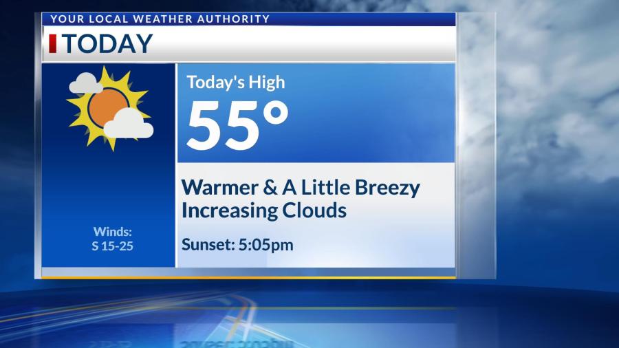
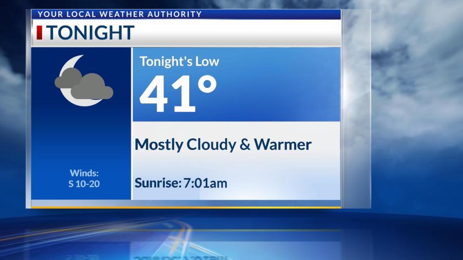
Friday will still be warm, just cloudy ahead of tomorrow’s snow system. This system will begin as rain near midnight tonight, and it will quickly transition to snow before sunrise Saturday morning. Temperatures will be at or below freezing through much of Saturday, so snow will persist through the afternoon, finally coming to an end for everyone by the early evening. 1-3″ of snow are possible once all is said and done, and higher totals should remain to our east. Winds will also gust up to 35 MPH through Saturday, allowing for wind chills to be in the lower 20s. Watch for any untreated roadways by Sunday morning, as they will likely freeze with temperatures dropping into the 10s. We’ll warm back into the 50s by Tuesday before a slight rain chance to our east Wednesday could cool us down below average by the end of next week.

Sunny and warm today; Cooler with snow accumulations on Saturday

Thursday will be the last day to enjoy sunny & warm conditions before cold & snowy weather return to the Four States on Saturday. Temperatures will still be warm through Friday, and we’ll be dry even with the cloud cover. Rain will begin late Friday night and transition quickly to snow by Saturday morning. Snow will likely persist through much of the day on Saturday, before temperatures warm above freezing by the afternoon. This means we could see another transition to a wintry mix/rain Saturday afternoon before drying out early Saturday night. Accumulation totals will be between 1-3″ across the Four States, and this will be a wet snow–great for packing snowballs! Enjoy the snow while it’s here, because it will likely melt by the start of next week as temperatures warm above average yet again.

Warm and breezy today; Cooler by the weekend

Temperatures today will warm into the middle to upper 50s, thanks to abundant sunshine and southwesterly wind gusts up to 30 MPH. Low temperatures overnight will be above freezing until we enter this weekend. We’ll be warm and sunny until Friday, when clouds increase ahead of a cold front. Rain is possible Friday night, and once temperatures drop below freezing, this could transition into a rain/snow mix early Saturday morning. Impacts and accumulations look minimal at this time, but we’ll keep you updated! Temperatures will fall into the 40s through the holiday weekend.

Rain before lunchtime; Clearing skies this afternoon

A few showers and storms are moving across the Four States this morning, but we’ll finally be dry by lunchtime Tuesday. Some heavy rain is possible with rainfall totals up to 1.5″ in some areas, especially to the northwest of Joplin. Everyone else should see less than an inch of rain before clouds quickly exit behind this system. We’ll see sunny skies, a southerly breeze and high temperatures in the upper 60s this afternoon.

Clouds will increase again overnight behind the passage of a cold front, and rain is possible again near sunrise and through Wednesday morning, with the bulk staying mostly to our east. We should remain dry through Thursday and Friday morning before we’ll be tracking another rain system that may be with us as we ring in the New Year. Stay tuned for updates!

Warm and breezy today with a slight rain chance; Cooler tomorrow

Friday in the Four States will be another warm and breezy one, but we’ll see mostly cloudy skies and a slight chance of rain between 10am-2pm today. Most will stay dry, and those that see this light rain will just see a trace of rainfall. This is ahead of a cold front that will ignite severe weather to our east tonight, but it will just decrease cloud cover and temperatures for the Four States. Tomorrow will see more average December temperatures with abundant sunshine this weekend. Sunday will kick off another warming trend into the middle of next week. We’re also watching another rain chance late Wednesday into Thursday as another cold front should cool us into the end of next week.

Warmer today; Rollercoaster of temperatures ahead

Wednesday has a cooler start to it, but we’ll warm above average today with highs in the middle to upper 50s and mostly sunny skies. Overnight, winds will pick up and gust up to 30 MPH through Friday ahead of a cold front. This will bring partly cloudy conditions and much warmer temperatures, including close to another record high temperature on Friday. Friday’s cold front won’t be associated with much rain, but a stray shower or two cannot be ruled out over the Four States. The bulk of the rain, however, should stay to our east. This will cool us to seasonal conditions on Saturday before we warm above average yet again into next week.

Mostly cloudy and cool today; Much warmer by the end of the week

Temperatures should warm to near average today with mostly cloudy skies. We should be in the 40s with a slight wind chill for the Joplin Christmas Parade tonight, so bundle up! The sun will make many appearances through Thursday as temperatures gradually rise into the middle 70s by Friday, potentially breaking another record high for December. A cold front will cool us down into the weekend, but rain is looking to stay primarily to our east during this event. We should warm above average again by the start of next week.

Warming through Saturday; Cooler by early next week

Temperatures are in the 20s to begin your Friday, but we’ll warm into the middle 50s this afternoon with a few more clouds in the sky. We’ll only cool into the lower 40s overnight before seeing highs in the lower 60s tomorrow. A cold front will approach us on Sunday morning, and we could see just a few sprinkles before sunrise. The rain will stay primarily to our east. However, this system will cool us into the upper 40s as we begin next week.

We’re also monitoring another cold front that could impact us late Wednesday and into Thursday. This would bring us some rain and cooler temperatures for Thanksgiving. We’ll keep you updated as the holiday gets closer.