Warm through Friday; Accumulating snow probable on Saturday

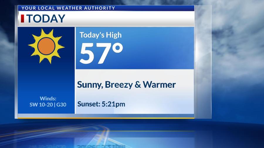
The rest of the work week will continue to see temperatures in the 50s, but clouds will increase on Friday–ahead of a system that will cool us into this weekend. Temperatures will drop below freezing Friday night into most of Saturday. This system will begin as rain near midnight or so into Saturday morning, and transition to snow through early Saturday afternoon. Right now, an estimate on accumulations is 1-3″, but this system could continue to change by the weekend. We’re still monitoring the location and timing of this snow, so stay updated through the week! Temperatures should warm back above average into next week.

Warm and breezy today; Cooler by the weekend

Temperatures today will warm into the middle to upper 50s, thanks to abundant sunshine and southwesterly wind gusts up to 30 MPH. Low temperatures overnight will be above freezing until we enter this weekend. We’ll be warm and sunny until Friday, when clouds increase ahead of a cold front. Rain is possible Friday night, and once temperatures drop below freezing, this could transition into a rain/snow mix early Saturday morning. Impacts and accumulations look minimal at this time, but we’ll keep you updated! Temperatures will fall into the 40s through the holiday weekend.

Windy and warm today; Colder with snow possible Thursday morning

Southerly winds will gust up to 40 MPH today, allowing temperatures to warm into the middle 50s for your Tuesday afternoon with mostly sunny skies. This is ahead of a cold front that will drop temperatures into the upper 30s for highs tomorrow and the middle 20s by Thursday. Late Wednesday night, we’ll be watching a clipper snow system that could bring an inch of accumulation to most of the Four States by Thursday morning. Ground temperatures should be cold enough for travel issues to ensue Thursday morning. This snow would end before lunchtime on Thursday, and temperatures will gradually warm above average again by Saturday.

Warming above freezing today; Breezy tomorrow ahead of a cold front

After a cold start, temperatures will finally warm above freezing this afternoon with abundant sunshine and calm winds. Southerly winds will pick up near sunrise tomorrow, allowing temperatures to warm into the lower 50s. This is ahead of a cold front that will cool us below average by Wednesday, and we could even see some flurries into Thursday morning. Not everyone in the Four States will see them, but those who do will likely see a dusting of accumulation. We’ll keep you updated this week when we can narrow down who exactly will see this light snow. All of us will warm above average again by the weekend.

Warm and breezy Friday; Rain transitions to wintry mix tomorrow morning

The last day of 2021 will be warm, cloudy and breezy with southwesterly winds gusting up to 30 MPH at times. Precipitation will begin as rain Friday afternoon, primarily near the MO-AR border. Flooding is possible near Table Rock Lake, and storms are possible closer to central Arkansas.

Rain will become widespread after midnight going into Saturday, but temperatures will be dropping through the day. Once they hit below freezing (likely before noon Saturday), rain will transition into a rain/snow mix. Ice accumulations are possible, and travel impacts could be seen along and north of I-44 through Saturday afternoon. If this system lingers into Saturday evening, snow is possible over parts of SE Kansas & SW Missouri, and accumulations will be low.

Wind chills will drop below zero into Sunday morning before high temperatures won’t get above freezing in the afternoon. We’ll finally start to warm back to average conditions by the start of next week.

Foggy Thursday morning; Wintry mix likely by Saturday

Thursday will begin with a Dense Fog Advisory in some parts of the Four States, with visibilities less than a mile in areas primarily east of I-49. We’ll see some sunshine this afternoon as temperatures warm into the middle to upper 50s. Temperatures will only cool into the middle 40s overnight.

The last day of 2021 (Friday) will be warm, breezy and a little rainy. Rain will begin in the afternoon for areas primarily south of I-44, and even some storms are possible southeast of the Four States. Rain will continue on and off overnight and into Saturday morning.

New Year’s Day will see temperatures steadily dropping through the day, and they will get below freezing by lunchtime. A wintry mix is likely through Saturday midday and afternoon, especially north of I-44. Travel impacts will be minimal, but it will be important to stay updated through the weekend.

We’ll see wind chills near 0 on Sunday morning before we warm up again into next week.

Rain before lunchtime; Clearing skies this afternoon

A few showers and storms are moving across the Four States this morning, but we’ll finally be dry by lunchtime Tuesday. Some heavy rain is possible with rainfall totals up to 1.5″ in some areas, especially to the northwest of Joplin. Everyone else should see less than an inch of rain before clouds quickly exit behind this system. We’ll see sunny skies, a southerly breeze and high temperatures in the upper 60s this afternoon.

Clouds will increase again overnight behind the passage of a cold front, and rain is possible again near sunrise and through Wednesday morning, with the bulk staying mostly to our east. We should remain dry through Thursday and Friday morning before we’ll be tracking another rain system that may be with us as we ring in the New Year. Stay tuned for updates!

Heavy rain possible with tonight's storm system

Temperatures won’t move too much through your Monday, but clouds will increase ahead of a rather large rain system tonight. After midnight, showers and thunderstorms will move across the Four States, with the main threat being heavy rain lingering well into Tuesday morning. Severe weather is not expected at this time. Rainfall totals will likely be between 0.5-1.5″ with locally higher amounts to our northeast. Some of these storms could create localized flooding in some parts of the Four States during tomorrow’s morning commute, so stay tuned for updates!

We should stay mostly dry through Tuesday afternoon through Friday morning before another rain system will move across the Four States as we may be ringing in the New Year. Temperatures will likely cool well below average behind this system. We’ll keep you updated through the week.

Wind gusts up to 50 MPH today; Storms likely this evening/night

The Four States are under a Wind Advisory until midnight tonight due to wind gusts up to 50 MPH expected through your Wednesday. We’ll see a windy, cloudy and warm day as temperatures will warm into the middle 70s this afternoon, likely breaking another record.

By 6pm, storms will form along a cold front in parts of Southeast Kansas, and these storms should be near Joplin and the I-44 corridor around 9pm. Strong winds, heavy downpours and frequent lightning are the main threats, but these storms likely won’t last too long once they start in your area. By 2am, all of the Four States will be clear, and temperatures & clouds will decrease into Thursday.

Rain will return Thursday night into Friday morning, and most of us will see on and off showers through Friday. We’ll be dry and cooler by Saturday as we slightly warm into the 50s by the First Day of Winter next Tuesday.

Warming trend through Wednesday; Windy conditions ahead of rain chances

Temperatures will warm into the middle 60s today with sunny skies and wind gusts up to 25 MPH, but today will mostly be calm. Winds take off through Wednesday, potentially gusting up to 40 MPH by the middle of the week, and allowing temperatures to warm into the 70s. A cold front will provide rain with potentially some storms Wednesday night into Thursday morning, that will cool temperatures into the 50s through Friday. This front could also provide more rain chances through Friday before cooling us into the 40s by the weekend. This forecast could change, so keep updated with the latest forecasts through the week.